Your search for 'rainfall' returned 1443 results.
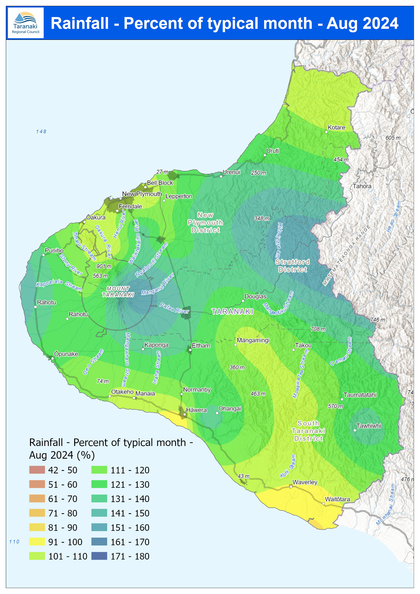
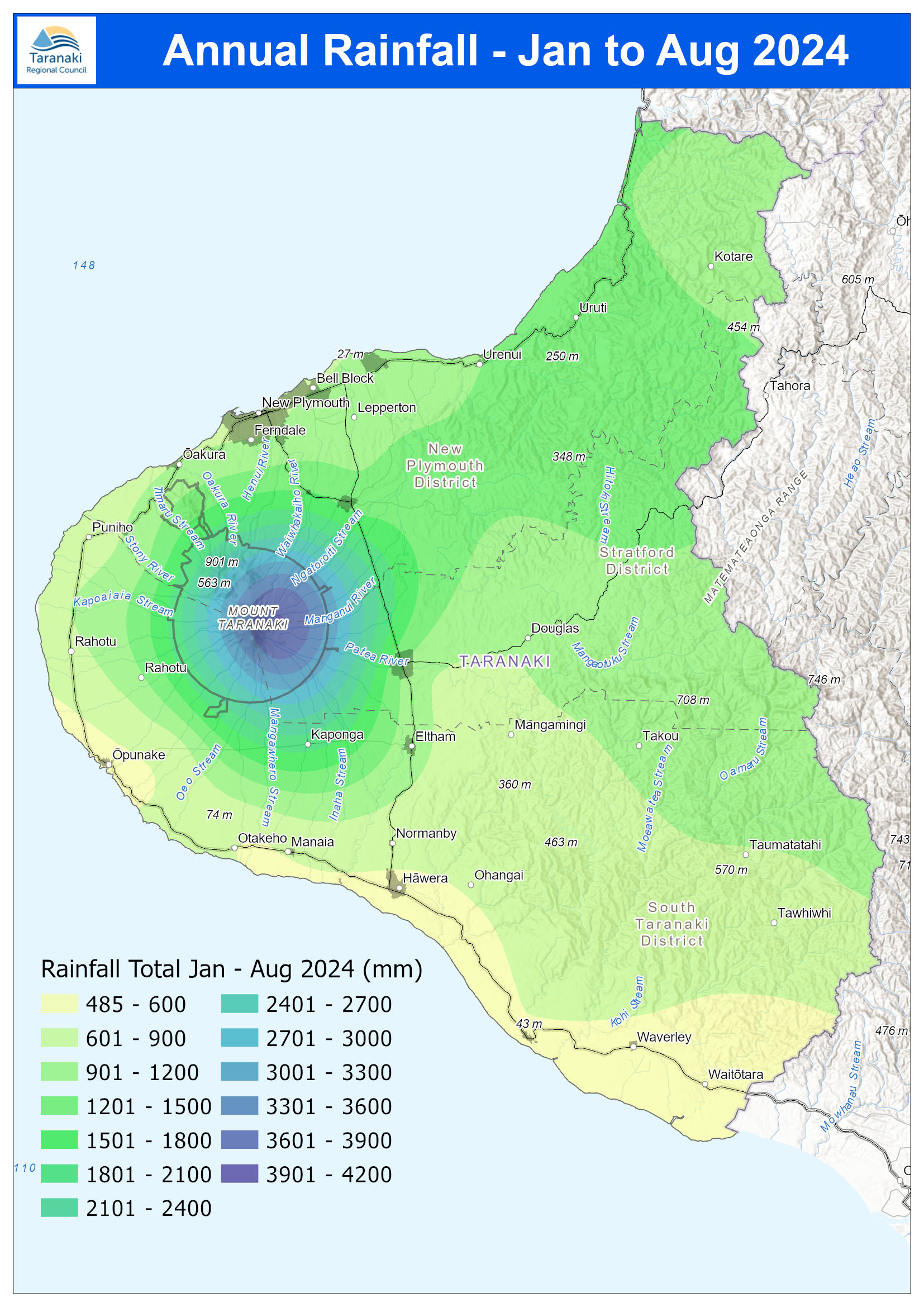
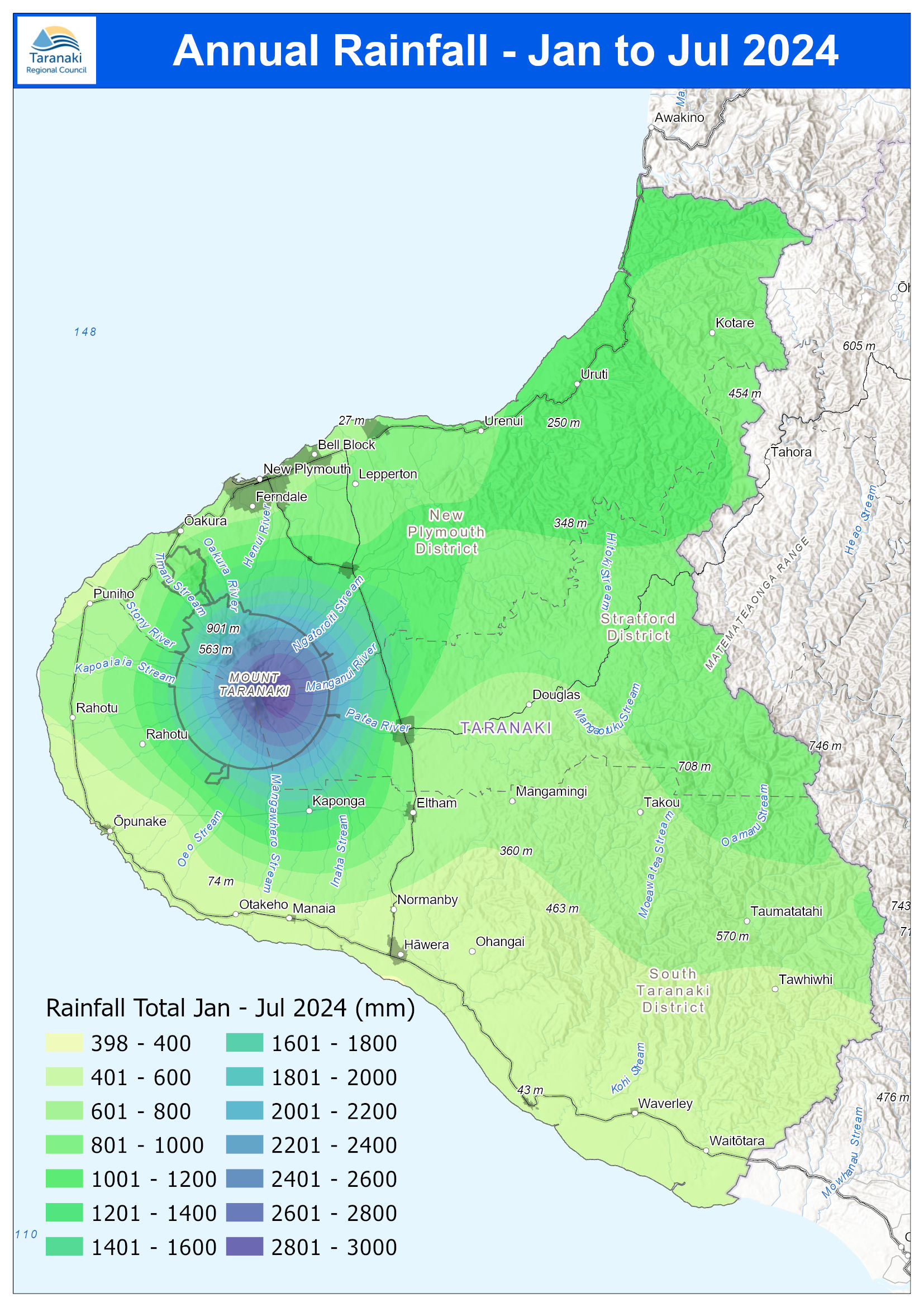
August 2024 Rainfall January to August
Irrigation Water Annual Report 2023-2024
specific range of monitoring carried out for each consent is dictated by the water source, weather and flow conditions, and irrigation system design. A total of 48 irrigation consents were exercised during the 2023/24 monitoring period, with irrigation commencing in mid-October and concluding in early April across the region. Rainfall recorded at the Council’s monitoring locations over the summer irrigation period ranged between 68% and 110% of historical mean values. Due to the lower than
January 2022 rainfall maps
page Provisional data onlyRegional Council Taranaki Total monthly rainfall (mm) xxx yy% KEY % of average rainfallmonthly xxx yy % NEW PLYMOUTH H WERAĀ ŌPUNAKE ELTHAM Kaka Rd P teaā K tareō Motunui Brooklands Inglewood Pohokura SaddleNorth Egmont Stratford Huinga Cape Egmont Dawson Falls Glenn Rd Whareroa Rimunui January 2220 Rainfall 8%11 15%21 9%8 12%10 16%21 16%19 17%68 13%14 22%18 19%18 16%52
December 2021 rainfall maps
page STRATFORD WAITARA Provisional data only NEW PLYMOUTH ELTHAM MANAIA Tota (mm)l monthly rainfall KEY xxx yy% INGLEWOOD Pohokura Saddle Dawson Falls Cape Egmont Stratford Whareroa North Egmont Inglewood Motunui Brooklands Kaka Rd Rimunui Glenn Rd Huinga 114% 162% 213% 1 %58 202% 221%239% 252% 272% 231% 288% 236% 267 335 432 270 1165 1003 259 280 257 300 301 205%
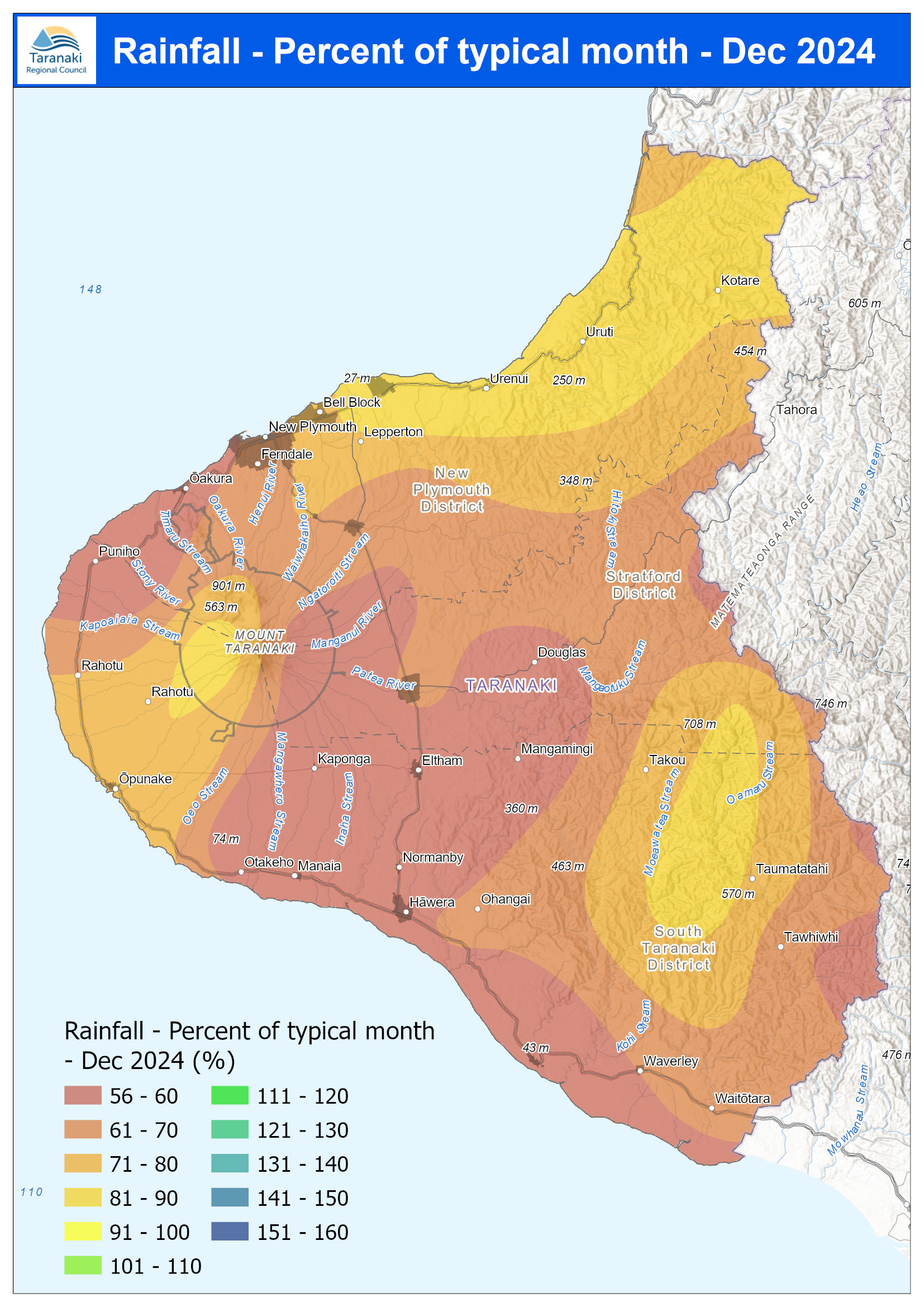
December 2024 Rainfall % of typical month
November 2021 rainfall maps
page page page page November 2021 Rainfall millimetres 0 - 25 26 - 50 51 - 75 76 - 100 101 - 125 126 - 150 151 - 175 176 - 200 201 - 225 226 - 250 251 - 275 276 - 300 301 - 325 page Spring 2021 Rainfall millimetres 0 - 150 151 - 300 301 - 450 451 - 600 601 - 750 751 - 900 901 - 1,050 1,051 - 1,200 1,201 - 1,350 1,351 - 1,500 1,501 - 1,650 page November 2021 Year to Date Rainfall
October 2021 rainfall maps
page page page October 2021 Rainfall millimetres 0 - 75 76 - 150 151 - 225 226 - 300 301 - 375 376 - 450 451 - 525 526 - 600 601 - 675 676 - 750 page October 2021 Year to Date Rainfall millimetres 0 - 500 501 - 1,000 1,001 - 1,500 1,501 - 2,000 2,001 - 2,500 2,501 - 3,000 3,001 - 3,500 3,501 - 4,000 4,001 - 4,500 4,501 - 5,000 5,001 - 5,500 5,501 - 6,000 6,001 - 6,500 October 2021