The torrential rain which hit Taranaki at the start of July saw many rivers hit incredible maximum flows of water including 417m³/sec in the Waiwhakaiho River at Egmont Village and 1,367m³/sec in the Waitara River at Bertrand Road.
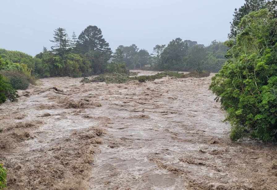
The Hangatahua/Stony River on 3 July.
Figures from Taranaki Regional Council show flooding at the Tāngāhoe River in South Taranaki was a one-in-20-year event (with 349m³/sec maximum flow) and the Waitōtara River experienced a one-in-11-year flood when the region was deluged by a huge amount of rain on 3 and 4 July.
Flooding in the Waiongana Stream on SH3A had an annual exceedance probability of 2.8%, making it a one-in-36-year event with a 194m³/sec maximum river flow.
The monitoring station at the Waiwhakaiho River at Egmont Village recorded 165.5mm in 12 hours on 3 July as many rivers and streams flooded and the public were urged to stay home and avoid any unnecessary travel as roads were inundated with surface water.
With more rain expected this weekend, Council Operations Director Daniel Harrison said the weather events are a stark reminder for the public to be aware of how fast rivers and streams can rise.
“The stats from early July are staggering as Taranaki was hit by huge downpours caused by thunderstorms with many waterways experiencing very rare flooding events,” Mr Harrison says.
“We’ve prepared for this with our management of flood defences in Waitara and at the lower Waiwhakaiho River and it was extremely pleasing to see how well the schemes worked given the huge volume of water in those rivers.
“We live in a fantastic part of the world but it’s fair to say the environment is extremely dynamic and things can change very quickly so please always be aware of the dangers from flooding and have a plan to get to safety if the rivers rise fast.”
The Council provides information to Taranaki Civil Defence Emergency Management (CDEM) about rainfall and river flows during weather events, and alerts are issued by CDEM to the public with support from the Council via its communication channels.
Other notable weather stats from last week include:
- The Council’s gauge on the Mangaehu River in East Taranaki recorded a maximum flow of 323m³/sec.
- The Waitara River gauge at the Pūrangi Bridge recorded 580m³/sec.
- The Tāngāhoe River maximum flow of 348.906m³/sec was well above the mean average flood of 164.302m³/sec (although records only date from 2018).
- The upper catchment flow site on the Waitōtara River (at Rimunui Station) recorded a peak water level of 12.5m (418m³/sec) at 11pm on 3 July.
- Brooklands Zoo recorded the most rain in a 1-hour period at 53.8mm since records began in 1872 (when monthly recordings began).
For updated information on rainfall, river flows and other climate data, head to the Council’s environmental data page here(external link). The regional overview is updated every 15 minutes. For details about the Council’s flood protection schemes, see here(external link).