water in those rivers. “We live in a fantastic part of the world but it’s fair to say the environment is extremely dynamic and things can change very quickly so please always be aware of the dangers from flooding and have a plan to get to safety if the rivers rise fast.” The Council provides information to Taranaki Civil Defence Emergency Management (CDEM) about rainfall and river flows during weather events, and alerts are issued by CDEM to the public with support from the Council via its
December continued 2024’s trend for lower rainfall with an average of 108.3mm - 34% less than usual. On average across Taranaki there was 14% less rainfall than normal across all rain gauges with year-to-date rainfall lowest at Waitōtara at Hawken Rd with 28% less than usual. In December, there was 63% less rain at Kaupokonui at Glenn Rd and 11% less at Motunui M39 at Weston W3. Mean river flows for December were 31.8% lower than typical values, low flows were 21.9% greater, and high flows
November continued the trend we’ve had pretty much all year for lower than average rainfall with our gauges recording an average of 125.3mm for the month – that's about 13% less than usual. Only four months this year – January, April, August and September – have seen higher than average rainfall and on average there has been 12% less than normal across all rain gauges. Year-to-date rainfall is lowest at Waitotara at Hawken Rd with 27% less rainfall than normal, Pohokura Saddle has had the
The weather stats are in for 2024 and if you live near Hawken Road in South Taranaki then last year you will have enjoyed the lowest rainfall and highest air temperature in the region. And those living near Ngutuwera, north of Waitotara, had to hang onto their hats on 4 February as the area recorded the highest wind gust for the year at 128.52km/hr. Figures from Taranaki Regional Council show the region, well known for enjoying a healthy dose of rain most years, recorded 14% less than normal
October continued this year’s trend for lower than average rainfall – but only just! There was an average of 158.2mm – that’s 1% less than usual – for the month, ranging from 26% less rain at Kaupokonui at Glenn Rd, and 22% more at Waitotara at Hawken Rd. On average there has been 12% less rainfall than normal across all rain gauges, with year-to-date rainfall lowest at Waitotara at Hawken Rd with 26% less rainfall than normal while the Pohokura Saddle has had the highest year-to-date rainfall
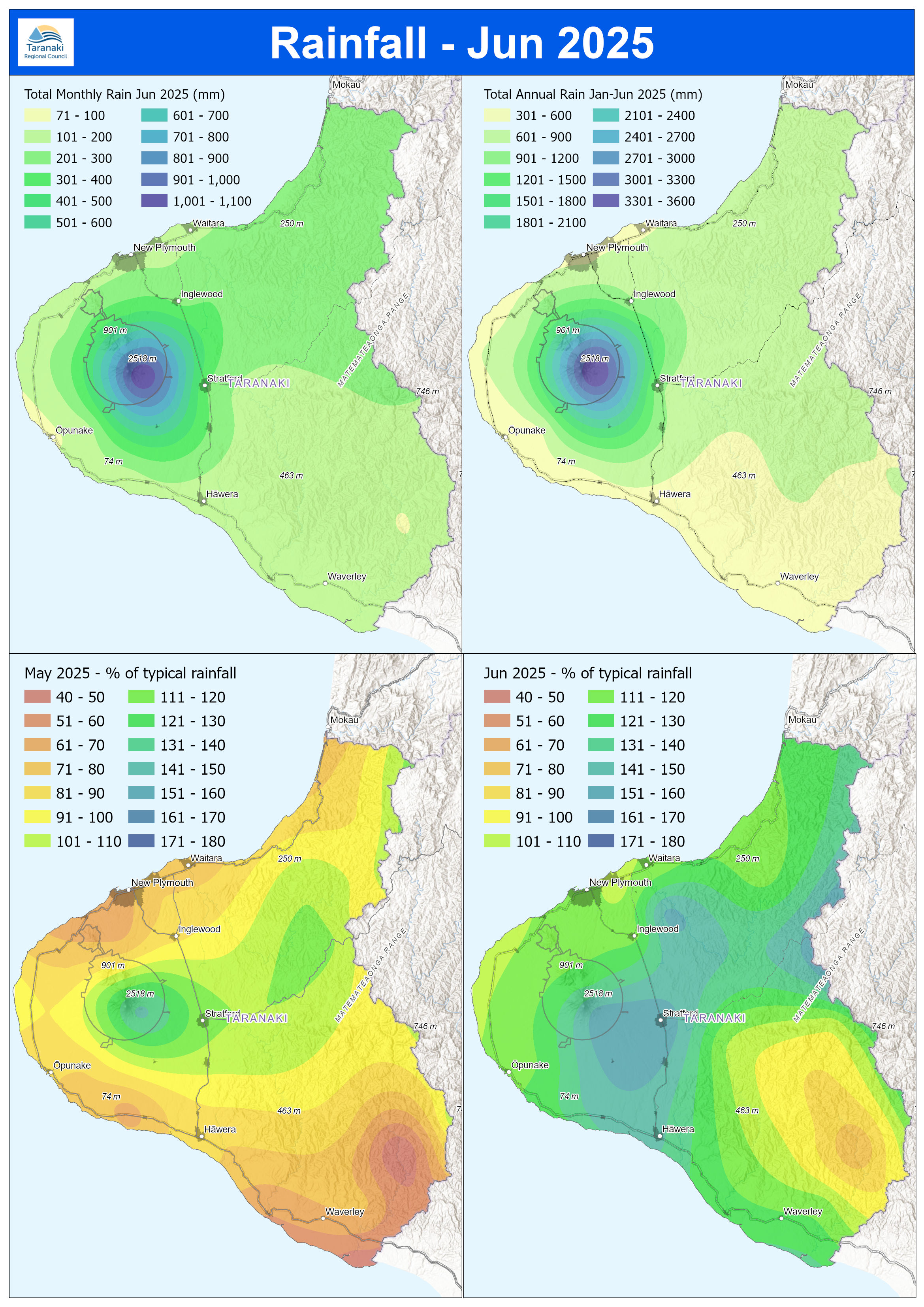
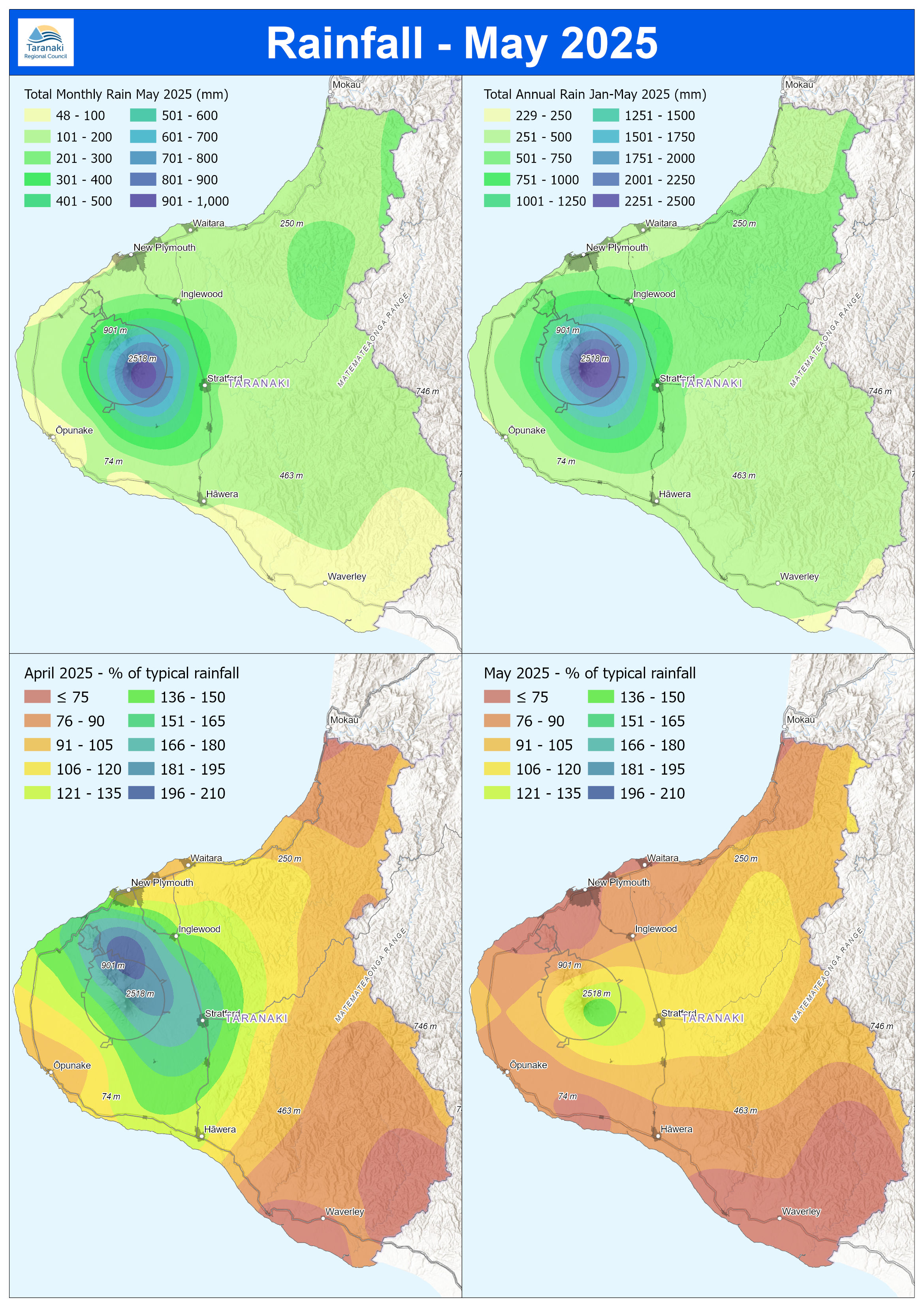
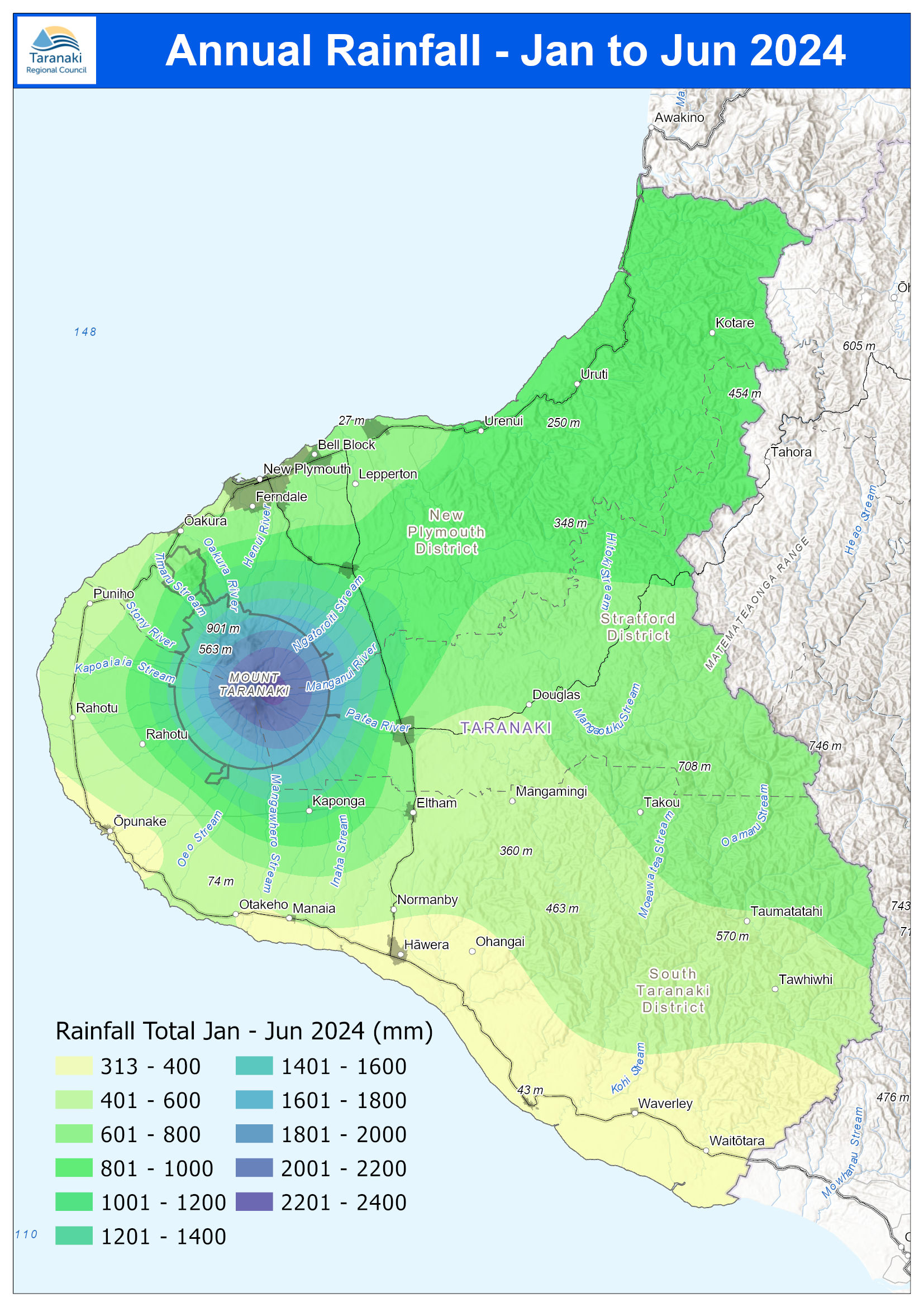
Our hydrology team crunches the data to bring you these monthly and yearly summaries. Note: The rainfall distribution maps (right column) are prepared using data interpolated from measurements taken at sites where rainfall is monitored by the Council. These maps are based on mathematical modelling and may not accurately represent actual rainfall in some unmonitored areas.
ill, while dogs may be attracted to the musty smell. “This is earlier than we typically expect to find cyanobacteria in our rivers and is likely due to the drier winter we had - heavy rainfall and high water flow help to flush cyanobacteria.” The Council is closely monitoring cyanobacteria levels at selected rivers and lakes (where it is called planktonic) as part of its Can I Swim Here? programme, which began this week and runs through until March. “As we kick off the Can I Swim Here? programme,