While Taranaki escaped the deluges brought by Cyclone Gabrielle as it hit the East Coast of the North Island, February was still a wet month for the region.

Rainfall was on average 140.4% of the long-term average, and ranged from 81% at Waiwhakaiho at Hillsborough to 257% at Omaru at Charlies. Year to date rainfall is sitting between 111% (Stony at Mangatete Bridge) and 334% (Whanganui at Mataimona Trig) with an average of 160.4% of normal. Compared to typical full year totals, sites have already received 17.6% of a typical year’s rainfall.
Mean river flows for February were 138.8% of typical values, low flows were 332.5%, and high flows 137.3%, of typical values while mean river (non-mountain) water temperatures were 17.4ºC, an average of -0.9ºC different to long-term February values. The average air temperature for the region (excluding Te Maunga sites) was 18ºC, which is - 0.3ºC relative to long-term February averages.
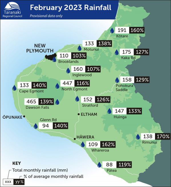
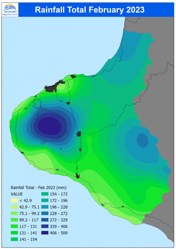
February 2023 rainfall maps
What you should know:
-
The site maps show data from a selection of the sites we monitor, but not all of them.
-
The distribution maps are based on mathematical modelling and may not accurately represent actual rainfall in some unmonitored areas.
Click on each map for larger version.
MONITORED SITES

RAINFALL DISTRIBUTION
